Wednesday, October 28, 2009

Salute Evacuation Model

We have arrived in Venice! While our team becomes acclimated to the new environment, we would like to share a portion of our previous work.
One of the primary reasons for studying pedestrian traffic is to get an idea on how pedestrians would behave in an evacuation scenario, so policies can be put in place by city officials to manage crises as efficiently and safely as possible.

Using code from a previous IQP, who examined mostly boat movement, we have put together a rough simulation of an evacuation of the area around the Salute church during the Nov 21 Festa della Salute.
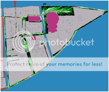


There is a video here, and our code can be found here.

Friday, October 16, 2009

Venetian Mobility: Modeling Movement by Land and Sea


We are pleased to announce that the proposal for the 2009 WPI Interactive Qualifying Project, Venetian Mobility: Modeling Movement by Land and Sea has been finalized and made available for viewing by the general public. This proposal represents seven weeks of focused and intensive work by our project team.

We would also like to acknowledge several individuals for their help in the creation of this proposal:

Fabio Carrera
Daniel Gibson
Stephen Guerin
Simon Mehalek
Andrea Mancuso
Christine Friese
Oljora Rezhdo


Moving forward, we are excitedly approaching our arrival in Venice and preparing accordingly.

Saturday, October 10, 2009

The Feast-day of the Madonna della Salute

"The Festa della Salute is probably the least "touristy" of the Venetian festivities and evokes strong religious feelings among the city's inhabitants.

The holiday is, like the Redentore, in memory of another bout of pestilence, which lasted for two years from 1630-31, and the subsequent vow by the Doge to obtain the intercession of the Virgin Mary.

Even today, thousands of inhabitants visit the main altar of the imposing Salute Church on November 21 to give thanks, and a strong symbolic tie remains between the city and the Virgin Mary."

For our project, this event will give us a valuable opportunity to examine the behavior of pedestrians in large densely packed crowds. Not only will we be able to use this data as a comparison point for our pedestrian model, but we can also use this event as a focus point for a model simulation of an evacuation event. A map containing the location of the temporary bridge is here.


View Salute Event in a larger map

Thursday, October 1, 2009

Vaporetti Map


The city of Venice has a public transportation system that consists of "water buses" or vaporetti that move around the city by a set network of stops, as seen on the right.  These traverse the city and also go to Marco Polo Airport, Lido, and Murano, among other key locations. 


Tuesday, September 29, 2009

MapInfo

Once we get the pedestrian data while in Venice, we will need to give context to the data in the form geographic locations in Venice. Thankfully, software for this purpose already exists, and is called GIS (Geographic Information Services). The software that has been used in the past is MapInfo. From there website "MapInfo Professional® is a powerful Microsoft® Windows®-based mapping and geographic analysis application from the experts in location intelligence. Designed to easily visualize the relationships between data and geography, MapInfo Professional helps business analysts, planners, GIS professionals – even non-GIS users – gain new insights into their markets, share information-rich maps and graphs and improve strategic decision-making." The 30 day evaluation version can be found here.

Tuesday, September 22, 2009

NetLogo

We are going to be using the NetLogo system to create an intelligent agent based model for pedestrian traffic in Venice. A useful tutorial can be found here. I have gone through the tutorial and am confident that this will be a very nice system to work with while creating our model. It is an IDE using a form of Logo that has been tailored to be used with intelligent agents. The syntax is pretty simple, so coding shouldn't be an issue.

IQP - Moving Around Venice

Our predecessor group, the Moving Around Venice project "refined tools to assist in managing Venice’s boat and pedestrian traffic. [They] monitored boat traffic at 19 intersections in Venice to improve the accuracy of a boat traffic model being developed by the Redfish Group. The completed model can be used to simulate the impact of changes in boat traffic regulations. Concurrently, [they] developed a pedestrian monitoring methodology to characterize behaviors of pedestrians in Venice. [They] used these behaviors to develop a model that can be used to manage plateatici (public spaces rented to private entities), which frequently encroach on pedestrian thoroughfares." By greatly expanding the pedestrian model to achieve the scope of the already actualized boat model, we hope to reach a point where the two models can be integrated, forming a comprehensive image of Venetian mobility. We will be expanding on the multimedia aspects especially, as getting the data out of the model is as if not more important than getting it in.

Some notable videos and links:
The map of venice and autonomous boat traffic
3D video of typical conditions found in Campo San Filippo e Giacomo
Netlogo project code